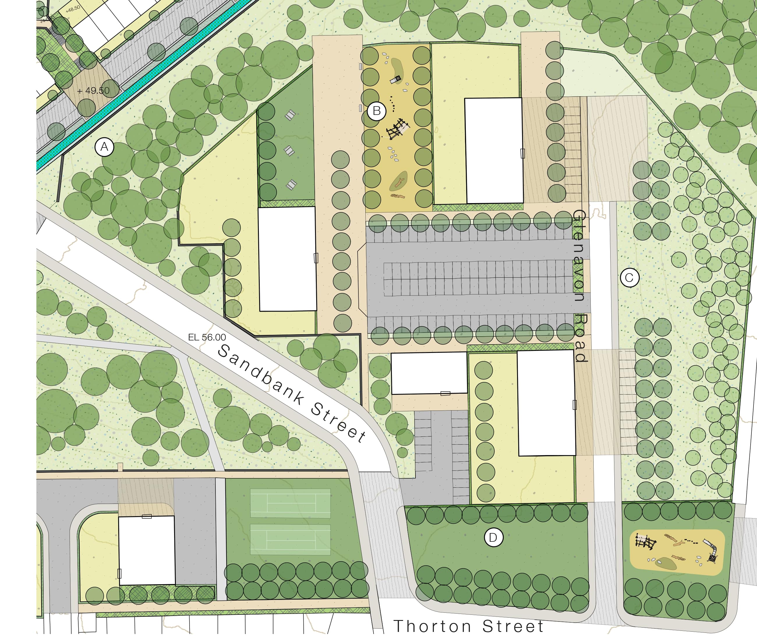
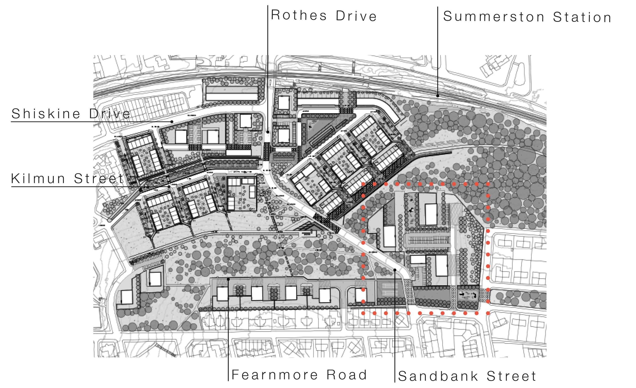
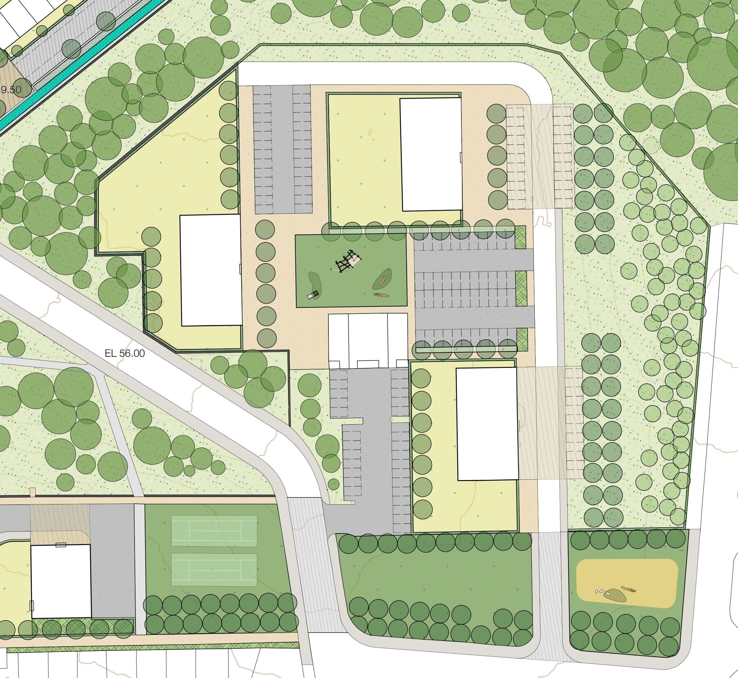
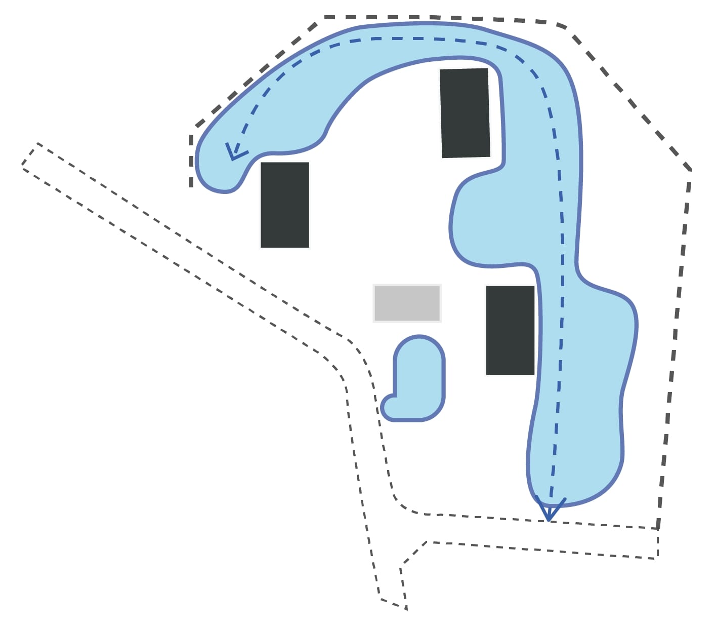
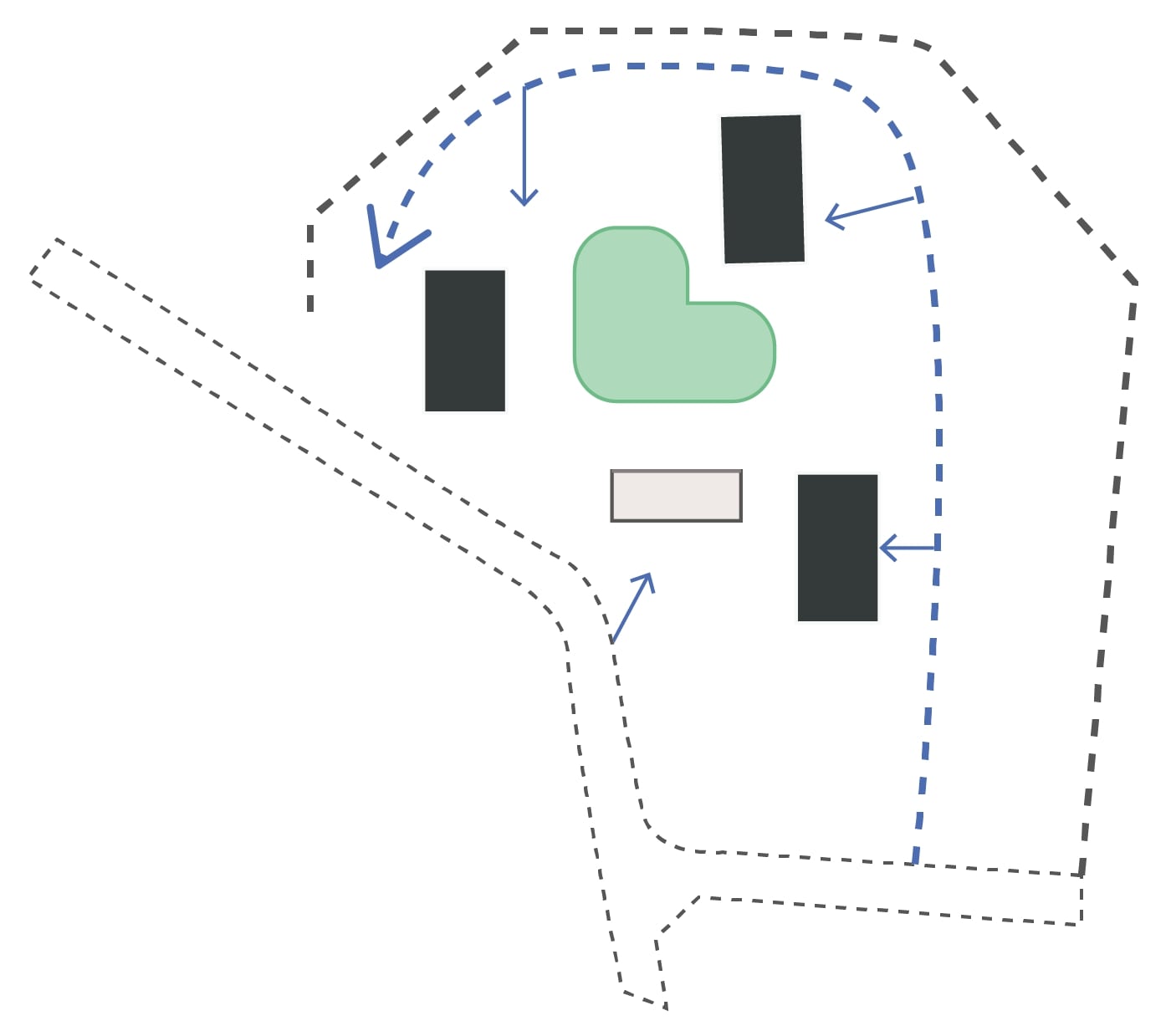
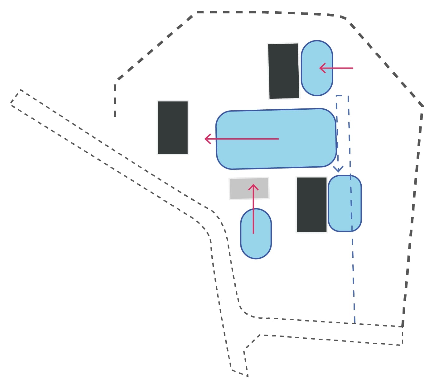
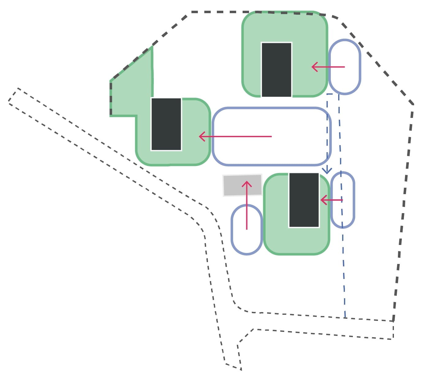
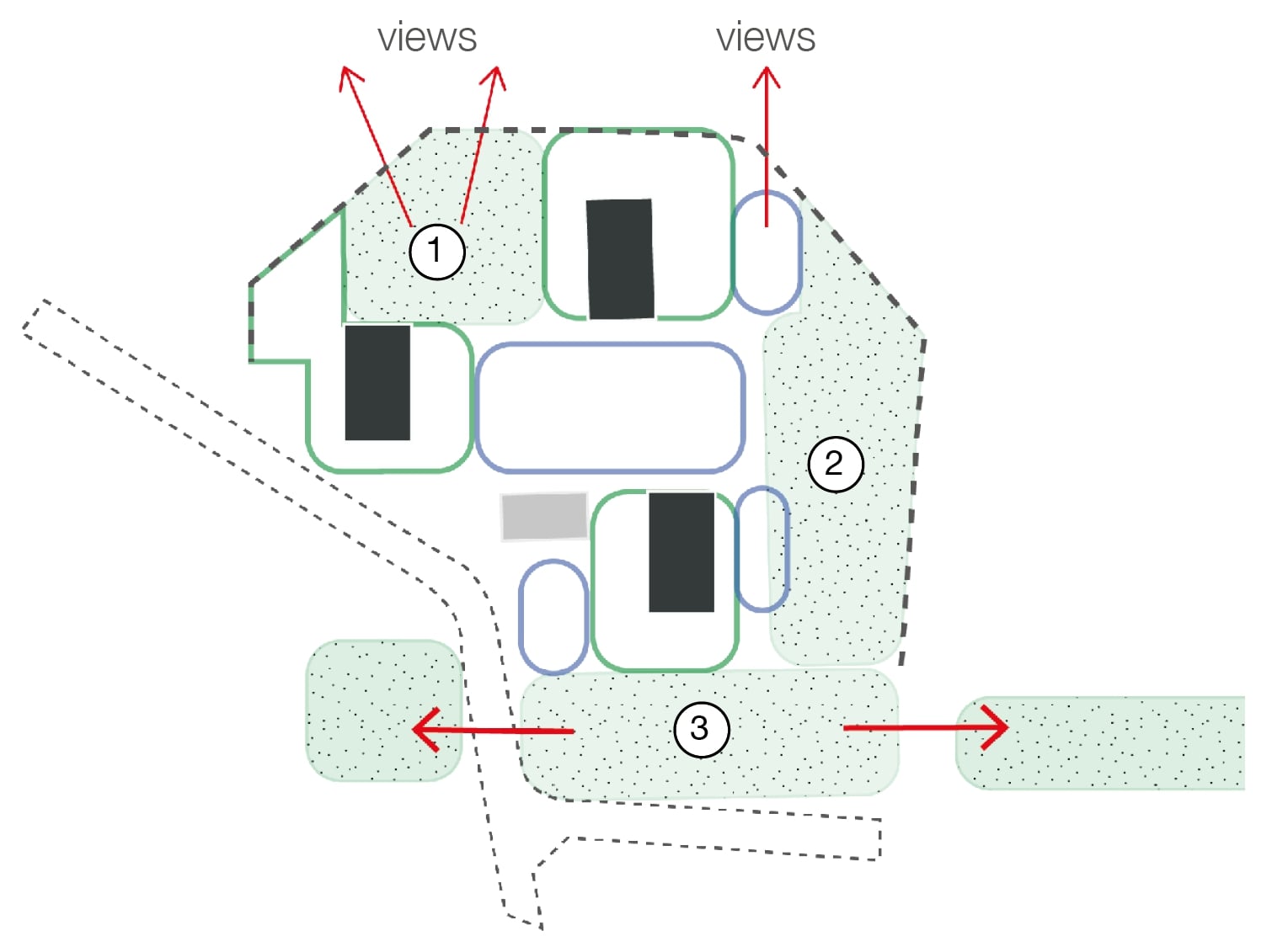
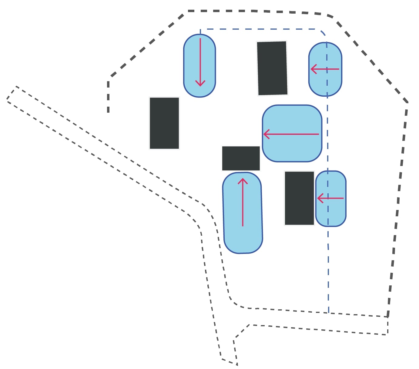
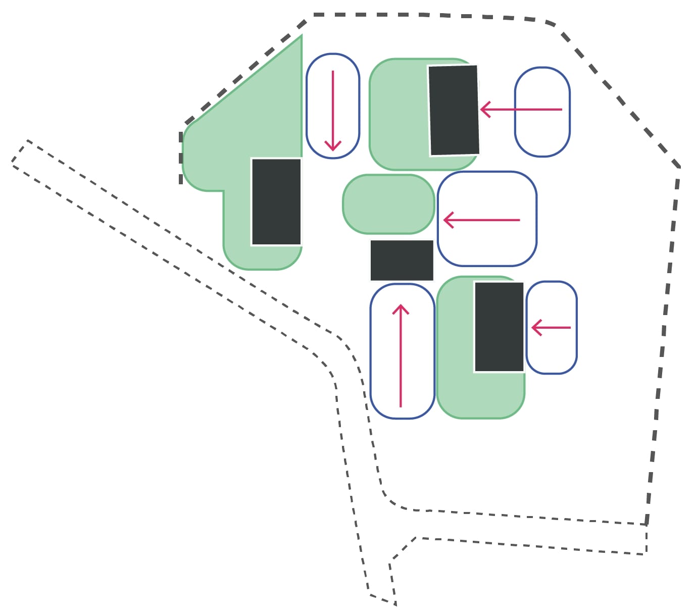
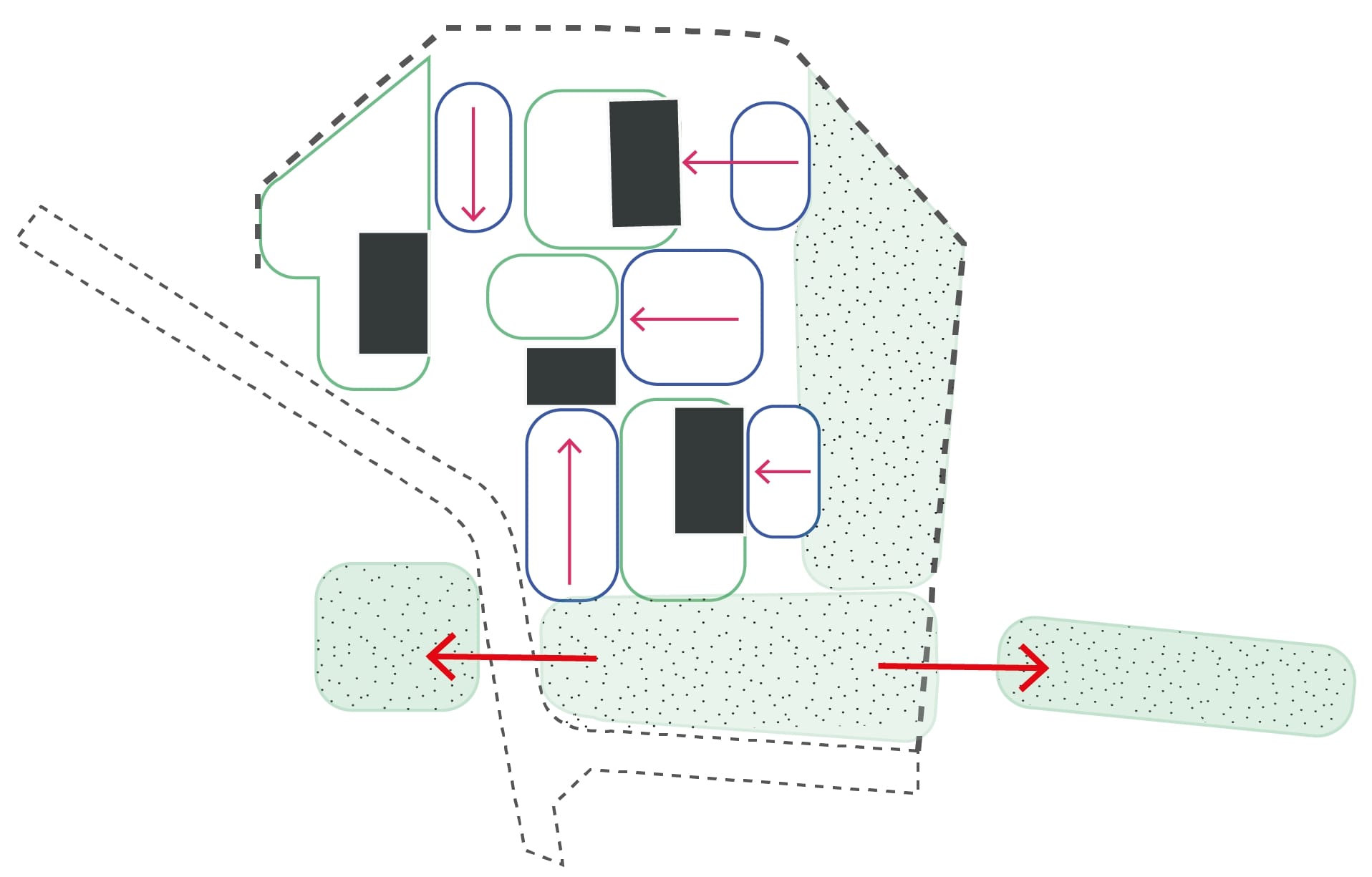
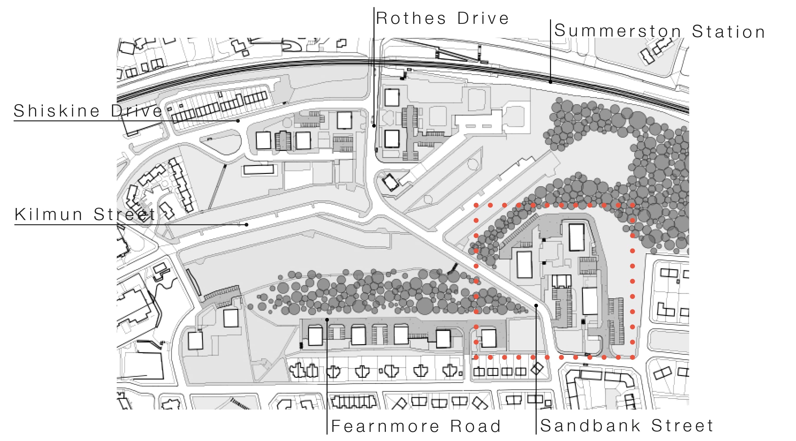
Maryhill North TRA

This Consultation has now ended

You can view the consultation materials below but will no longer be able to comment on them.

Glenavon Housing

Give your views on plans to improve the areas around the Glenavon blocks

Existing plans

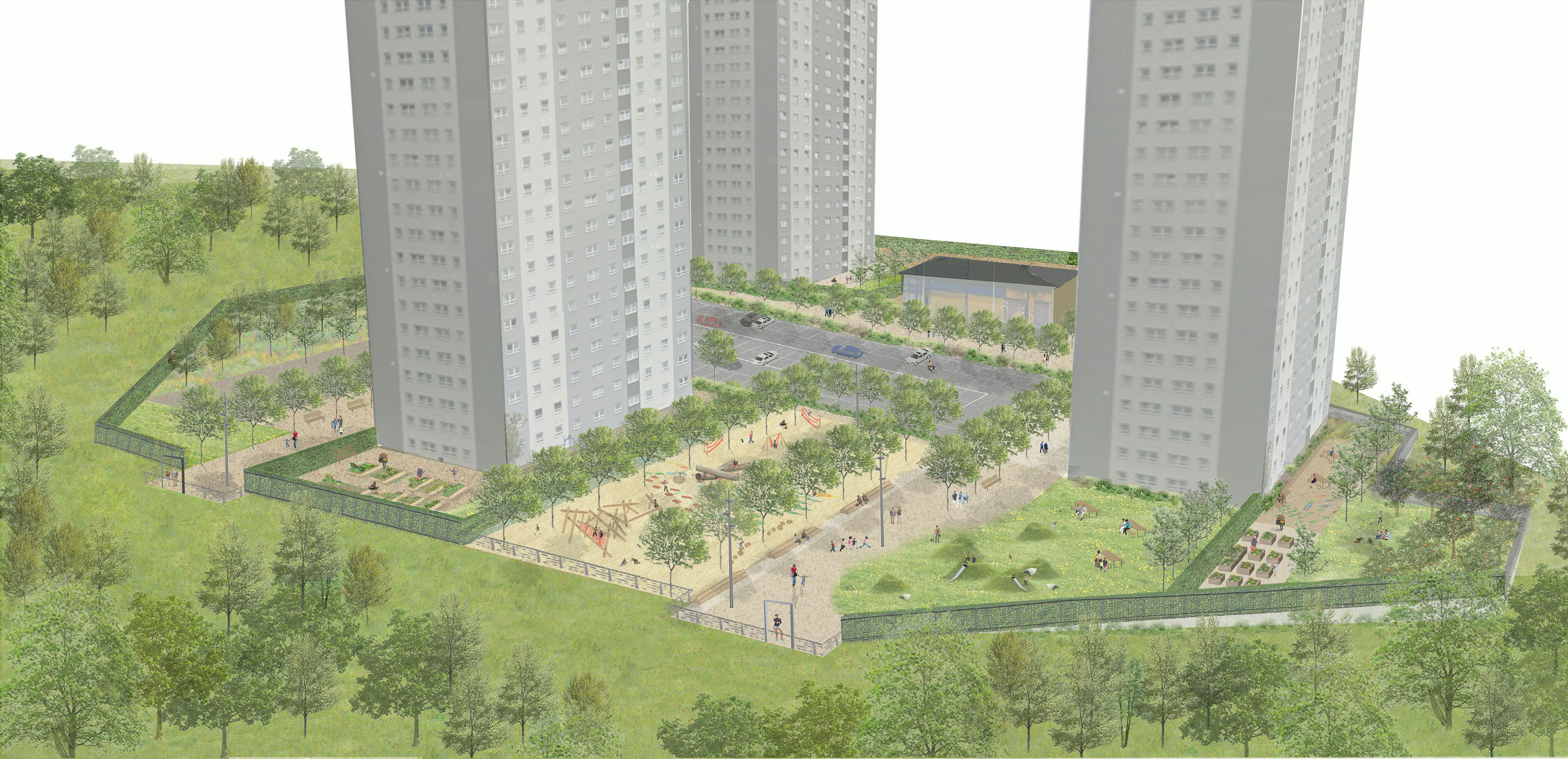
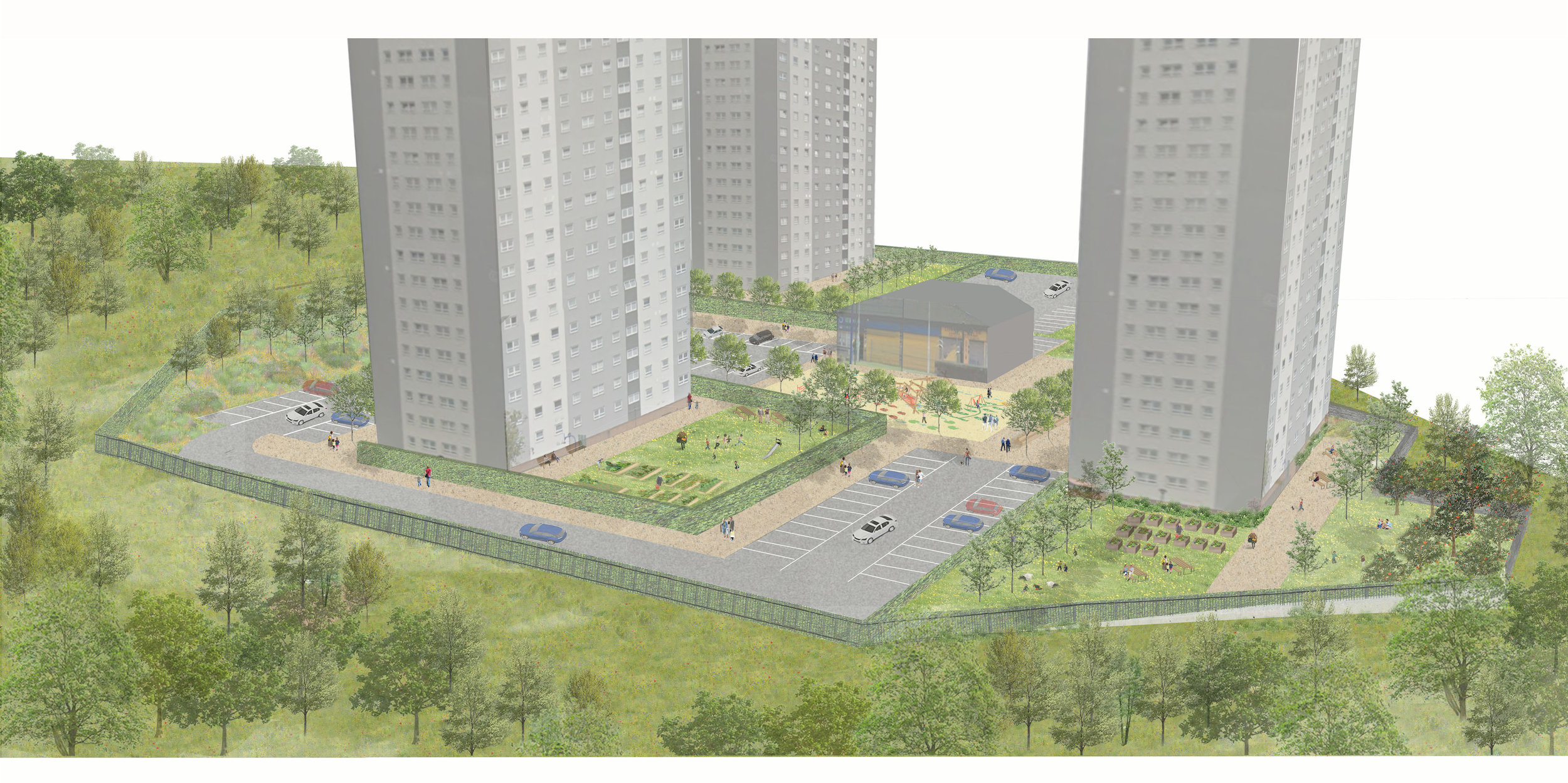
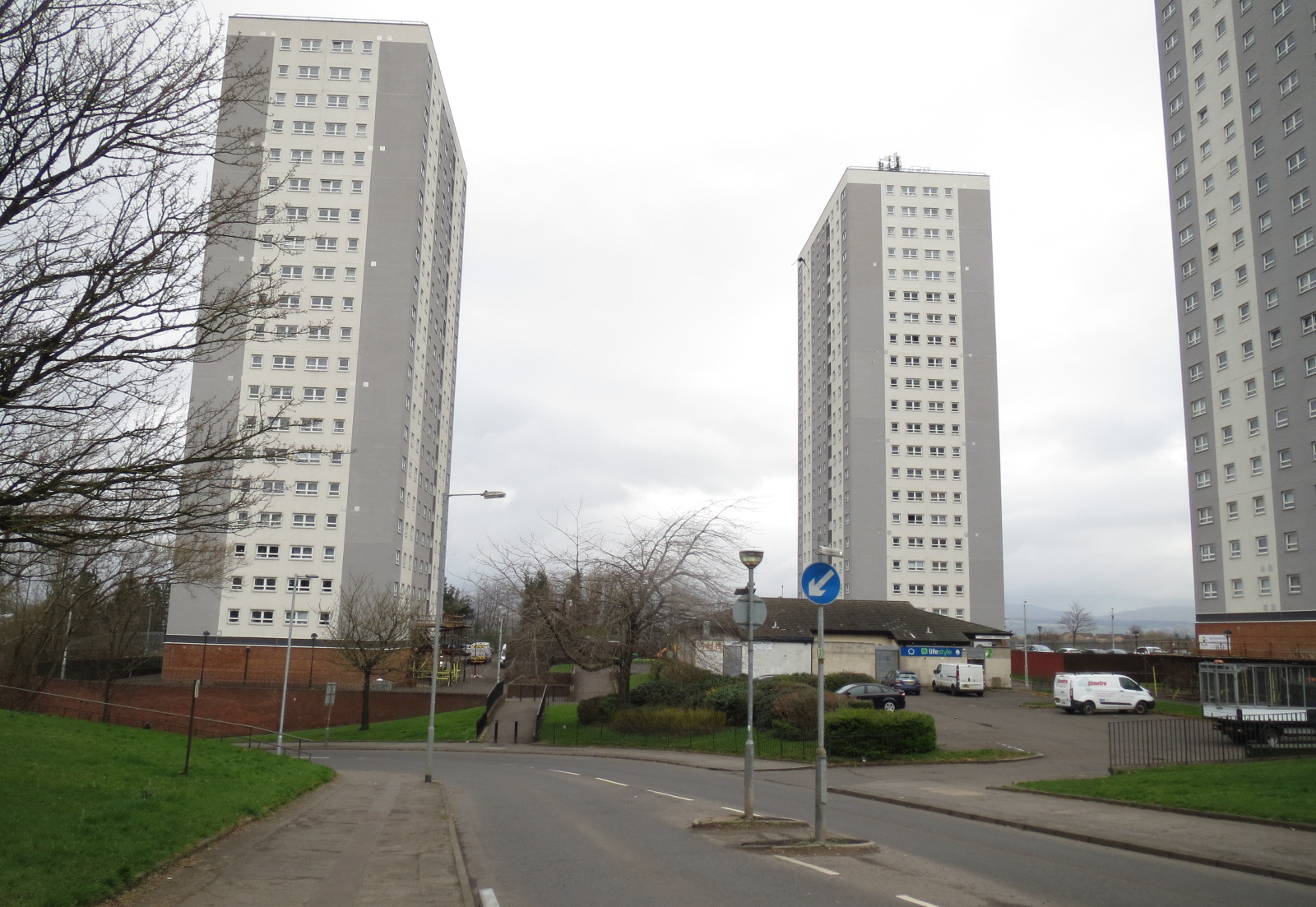
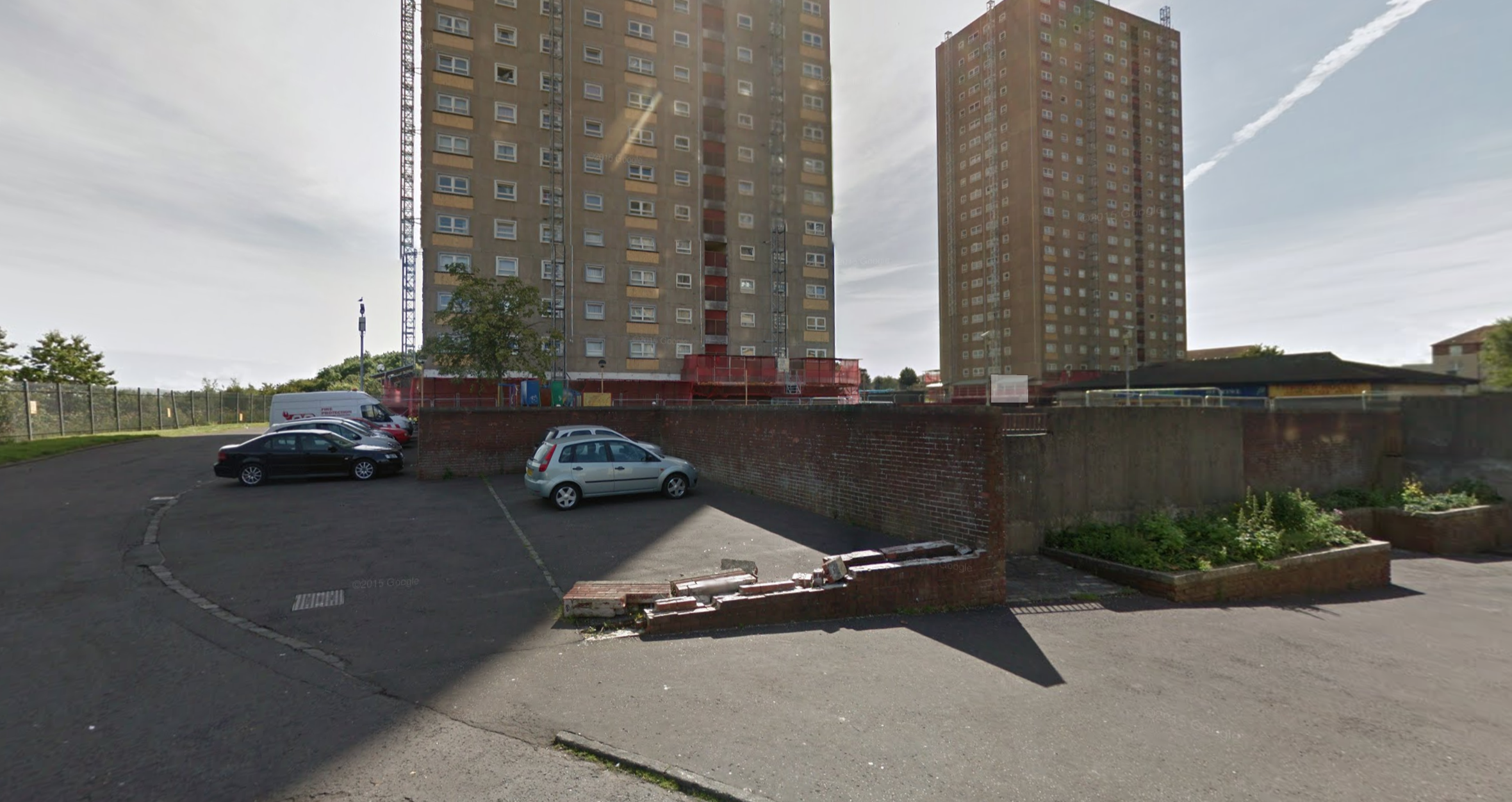
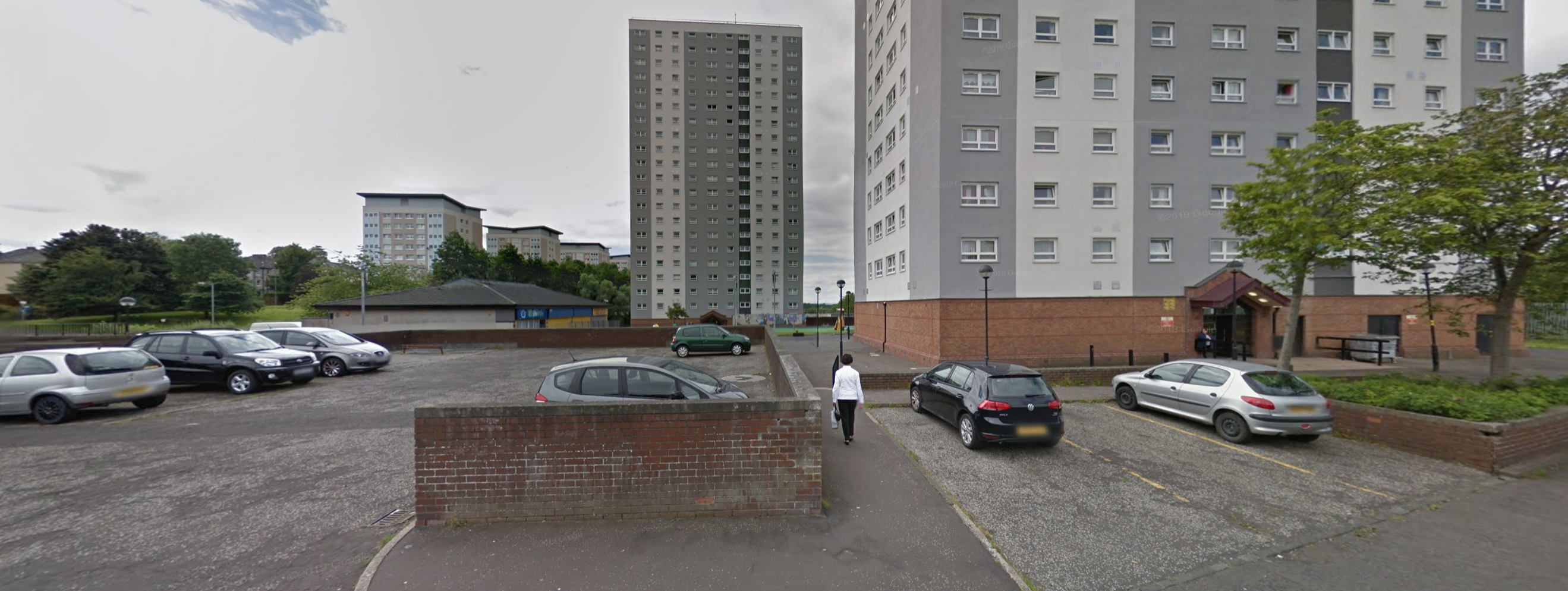
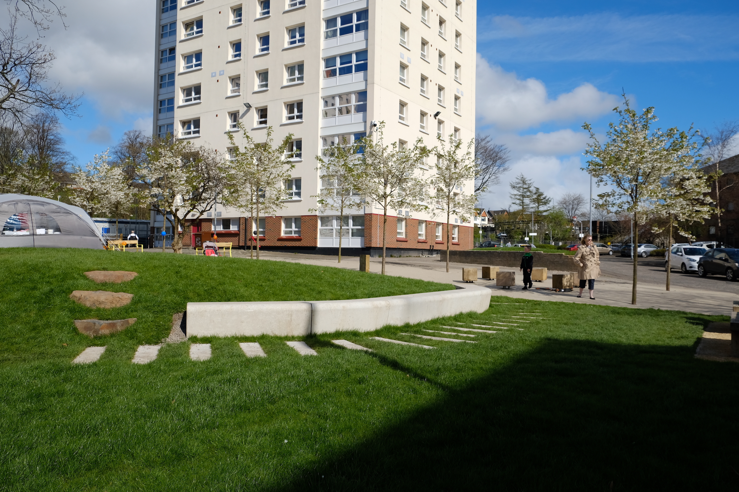
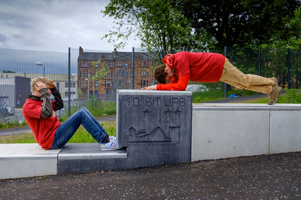
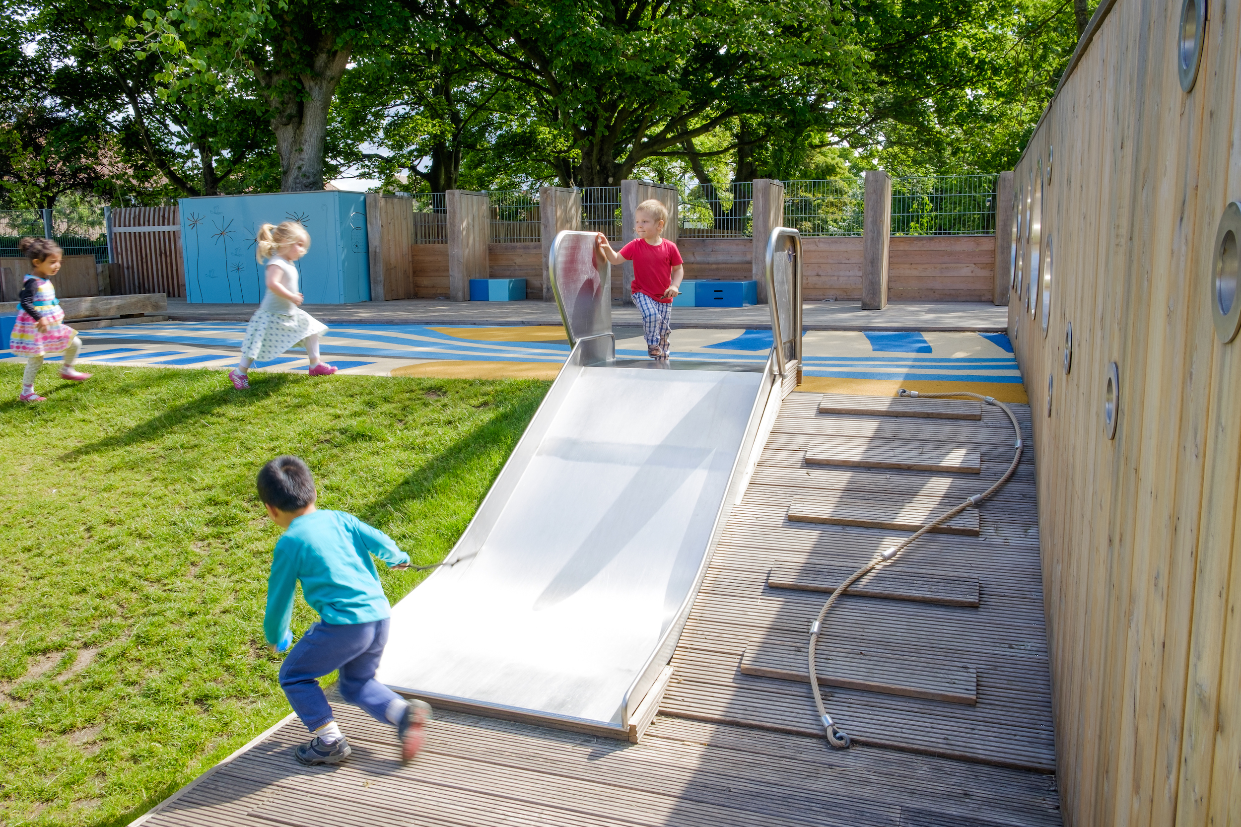
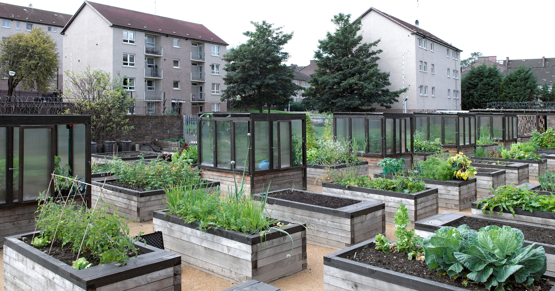
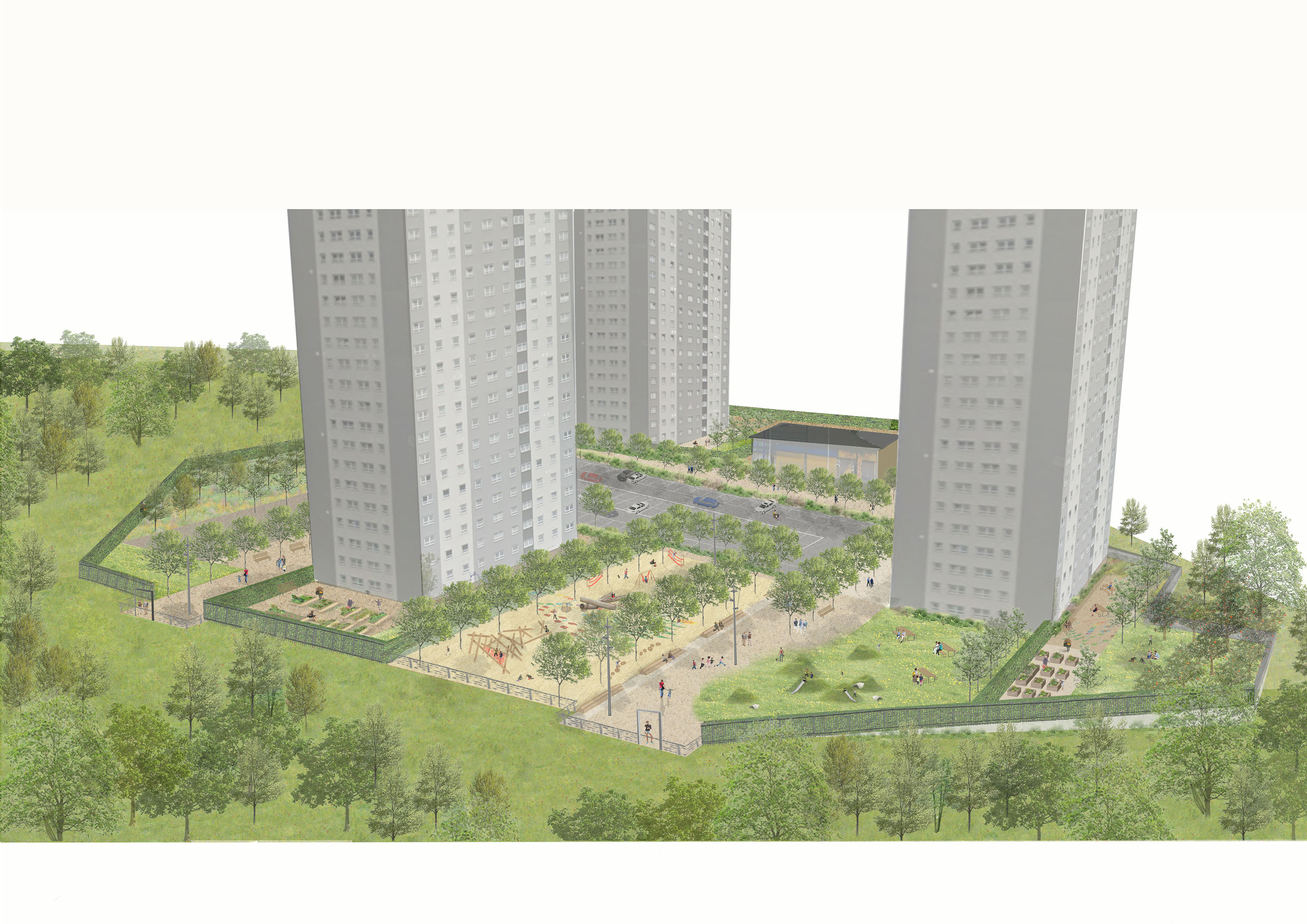
These images show how the area around the Glenavon high rise currently looks. There is a well-used playarea and ball court but a lot of the other space between the blocks is poor quality.

Existing Site Overview B&W

You can zoom in on the image by pinching it.

Existing Site Overview Colour

You can zoom in on the image by pinching it.


Option 1

In this option, the parking is moved to the centre of the blocks and a new playarea is moved to an improved location between 71 and 115 Glenavon Road. This creates space to include a lot more high-quality communal facilities around the blocks, such as growing spaces. These spaces would be private for the residents of each block. The shops would be moved to a new location closer to Sandbank Street.

Indicative Visualisation
Visualisation

You can zoom in on the image by pinching it.

Proposed Plan B&W

You can zoom in on the image by pinching it.

Proposed Plan Colour

You can zoom in on the image by pinching it.


DRAG THIS AROUND OR RESIZE IT TO HELP YOU SEE

New neighbourhood park connecting to existing park and wider network of greenspace

Existing woodland retained, managed and expanded

Communal playground, seating and open space

Community Park & Woodlands

Proposed Trees

Wildflower meadow

Communal residents' space / gardens

Traffic calming measures

Option 2

In this option, the shops would stay in their current location. There would be some parking moved to the middle of the blocks but some parking would remain around the outside of the blocks. There would still be communal areas created private to each block. The playarea would remain roughly in its current location in the middle of the blocks.

Visualisation

You can zoom in on the image by pinching it.

Proposed Plan Option 2 B&W

You can zoom in on the image by pinching it.

Proposed Plan Option 2 Colour

You can zoom in on the image by pinching it.


DRAG THIS AROUND OR RESIZE IT TO HELP YOU SEE

Existing woodland retained, managed and expanded

Communal playground seating and open space

Community park and woodlands

New neighbourhood park connecting to existing linear park and wider green network

Proposed Trees

Wildflower Meadow

Traffic calming measures

Communal residents space / gardens

What is the area around Glenavon currently like?

KEY POINTS


  • Parking and roadway route around the outside of the high rises.
  • Residents' green space is disconnected from the main routes due to high walls. As a result not many people use the green space and it may feel unsafe.  
  • There is no residents' communal space associated with each high rise.
  • The route into the high rise by Glenavon Road is dominated by roadways and parking. There is a lack of pedestrian space at entrances or usable outdoor residents' space.

More detailed review of the Glenavon Road area

Click the arrows or use the buttons below to view each image

  • A

    A
    DRAG THIS AROUND OR RESIZE IT TO HELP YOU SEE

    Buildings

    Vehicle access and parking

    Vehicle route

    Local shops

    KEY POINTS


    • High rises with road and parking around the outside

  • B

    B
    DRAG THIS AROUND OR RESIZE IT TO HELP YOU SEE

    Buildings

    Disconnected communal greenspace

    Vehicle circulation

    KEY POINTS


    • Residents' green space is central but not accessible from the routes to the high rise blocks because of the numbers of steps and high walls. This may make the area feel unsafe. 
    • There is no private residents' communal space associated with each high rise.
    • The route to the high rises is dominated by the road and parking. There is a lack of space at the entrance to each block for people walking into each block.

Pictures of the Glenavon area

Click the arrows or use the buttons below to view each image

  • View north from Sandbank St

    View north from Sandbank St
    View north from Sandbank St
  • Glenavon Road (prior to overcladding works)

    Glenavon Road (prior to overcladding works)
    This pictures shows the high walls around the car parking area because of the level changes
  • Car parking off Glenavon Road

    Car parking off Glenavon Road
    Car parking off Glenavon Road

Proposed plans in more detail

These sections provide a more detailed explanation of the proposed options.

Option 1 - shops are moved and the parking moves to the middle of the blocks

Click the arrows or use the buttons below to view each image

  • A

    A
    DRAG THIS AROUND OR RESIZE IT TO HELP YOU SEE

    Shortened vehicle route

    Buildings

    Parking zones

    Central route

    Relocated local shops

    Key Points


    • Cars would stop driving round the outside of the blocks
    • Most parking would move to the area between the high rise
    • This would mean that most people would enter the blocks from the same place. This would help the area to feel safer
  • B

    B
    DRAG THIS AROUND OR RESIZE IT TO HELP YOU SEE

    Buildings

    Parking zones

    Defined space around high rises

    Central route

    Relocated local shops

    Key Points:


    • Private communal areas would be created at the bottom of each high rise, just for the residents of the blocks.
    • Residents' areas would include communal gardens, seating, play, growing space, etc
    • There would be improved routes to the entrance of each block
  • C

    C
    DRAG THIS AROUND OR RESIZE IT TO HELP YOU SEE

    Neighbourhood Park including play etc.

    Community Woodland

    Neighourhood / Public park incl. sports pitches etc and improved links to local greenspaces

    Local shops relocated further south

    Key Points:


    • New green spaces would be created including: play areas, sports facilities, community woodland, etc.
    • The area would be better linked to other green areas in the neighbourhood with new walking and cycling routes.
    • The new communal spaces would benefit from the view to the hills.

Option 2 - shops stay in their current location

Click the arrows or use the buttons below to view each image

  • A

    A
    A
    • Cars would not drive right around the area
    • Some of the parking would move to the middle of the blocks
    • This would aim to get more people using the central areas
  • B

    B
    B
    • Private spaces would be created for each block, just for the residents on each block.
    • Residents spaces would include: communal gardens, seating, play, growing space, etc
    • The entrance to each block would be improved
  • C

    C
    C
    • Green spaces would be created including play areas, sports facilities, community woodland, etc.
    • Routes to green space in the neighbourhood would be improved with new walking and cycling routes
    • The new communal areas would make use of the views to the North

This section shows examples from other areas

Click the arrows or use the buttons below to view each image

  • Dalmuir housing, community greenspace and seating, erz

    Dalmuir housing, community greenspace and seating, erz
    Dalmuir housing, community greenspace and seating, erz
  • Possil gym wall, erz

    Possil gym wall, erz
    Possil gym wall, erz
  • Arcadia nursery, playscape, erz

    Arcadia nursery, playscape, erz
    Arcadia nursery, playscape, erz
  • Shettleston community growing, erz

    Shettleston community growing, erz
    Shettleston community growing, erz

What do you think? (feedback survey)

Please answer the questions below to tell us what you think about the proposals

This survey has ended. Thank you for all your responses.