Vision
The plans below show what the new neighbourhood could look like compared to what it looks like now. Please review these plans and give your views.
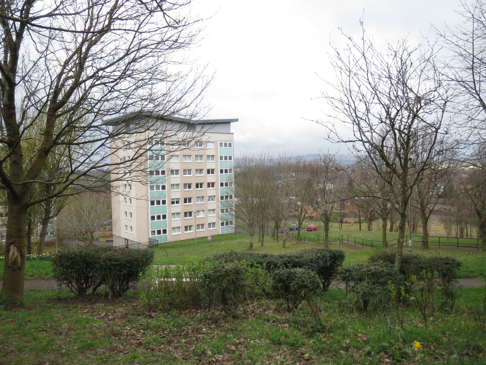
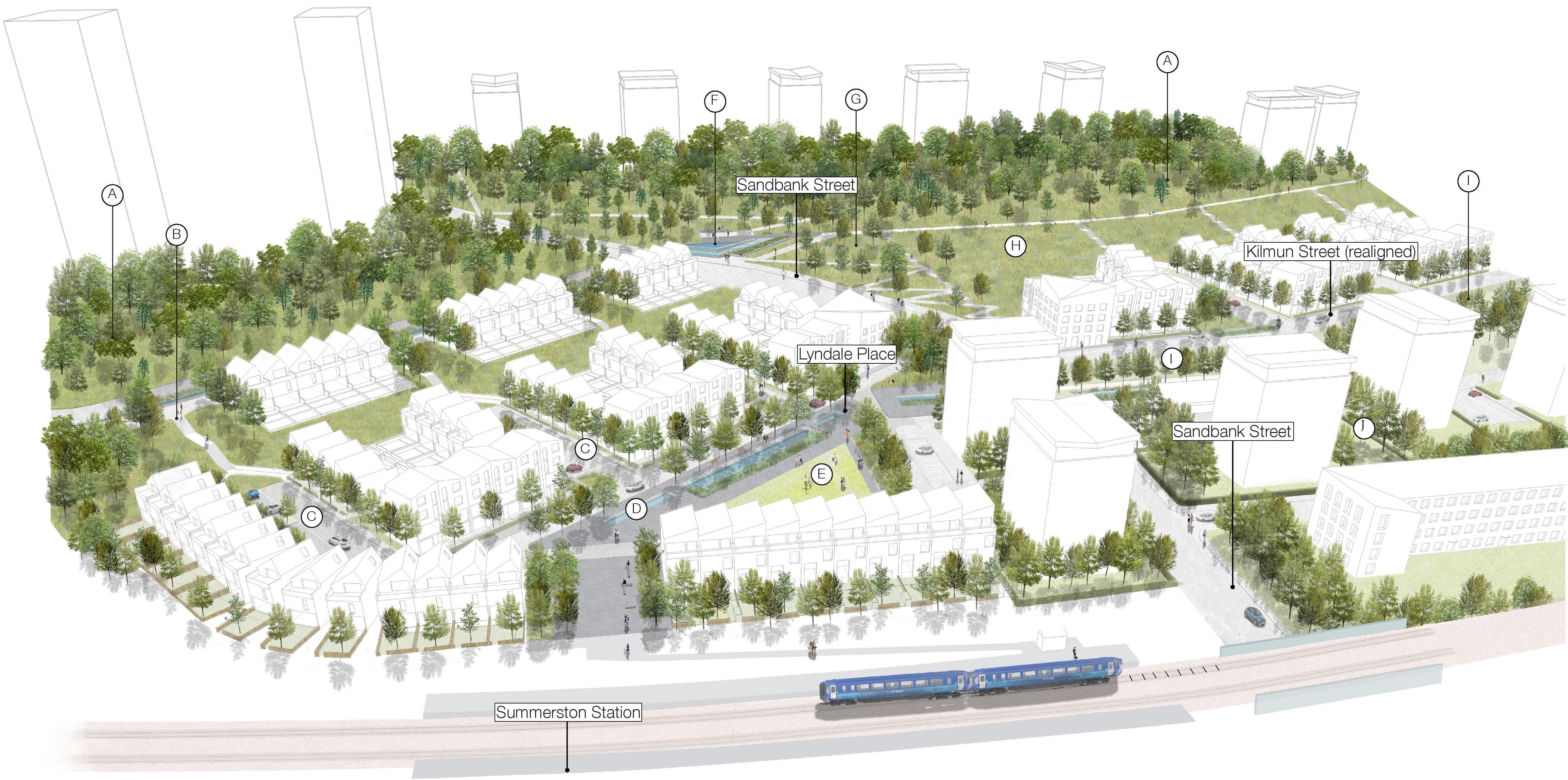
General view of the neighbourhood from Summerston train station
You can zoom in on the image by pinching it.
DRAG THIS AROUND OR RESIZE IT TO HELP YOU SEE
Existing woodland to remain and be expanded
New paths with steps
New streets with trees and housing
New water feature
New park
New park
New path without steps
New wildflower meadow
New route for walking and cycling running through the neighbourhood
New improved community spaces

Before / After
Click the image or use the arrows to compare before / after
DRAG THIS AROUND OR RESIZE IT TO HELP YOU SEE
New route for walking and cycling running through the neighbourhood
New route for walking and cycling running through the neighbourhood
New paths with steps
New improved community spaces
New park
New water feature
New path without steps
New path to new water feature
New park
Existing woodland retained and expanded
Existing grass areas retained

Proposed trees

Existing trees

Wildflower meadow areas

Developed parkland / greenspace

Proposed shrub planting

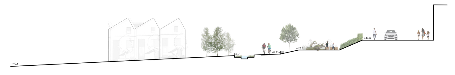
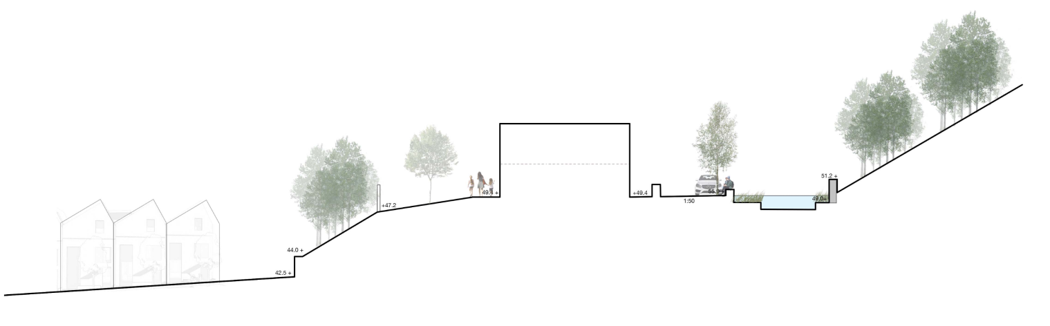
Surface water management / storage feature

Dry swale

Green streets

Public realm / traffic calming measures

Private / communal garden space
Before / After
Click the image or use the arrows to compare before / after
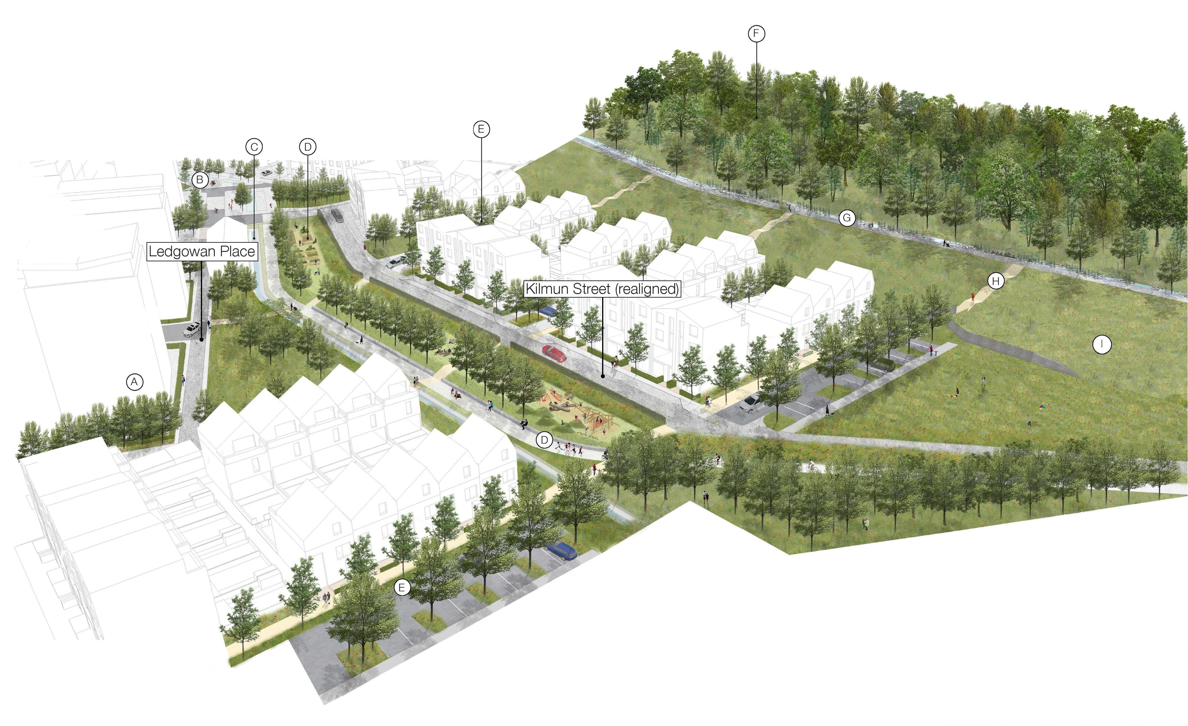
View of the existing Kilmun Street area
You can zoom in on the image by pinching it.
You can zoom in on the image by pinching it.
DRAG THIS AROUND OR RESIZE IT TO HELP YOU SEE
New improved community spaces
Changes to road crossings to reduce car speeds
New water feature
New route for walking and cycling running through the neighbourhood
New streets with trees
Existing woodland retained and expanded
New route for walking and cycling running through the neighbourhood
New paths with steps
New wildflower meadow

Area around Sandbank Street where Kilmun Street and Barrasdale Road currently meet
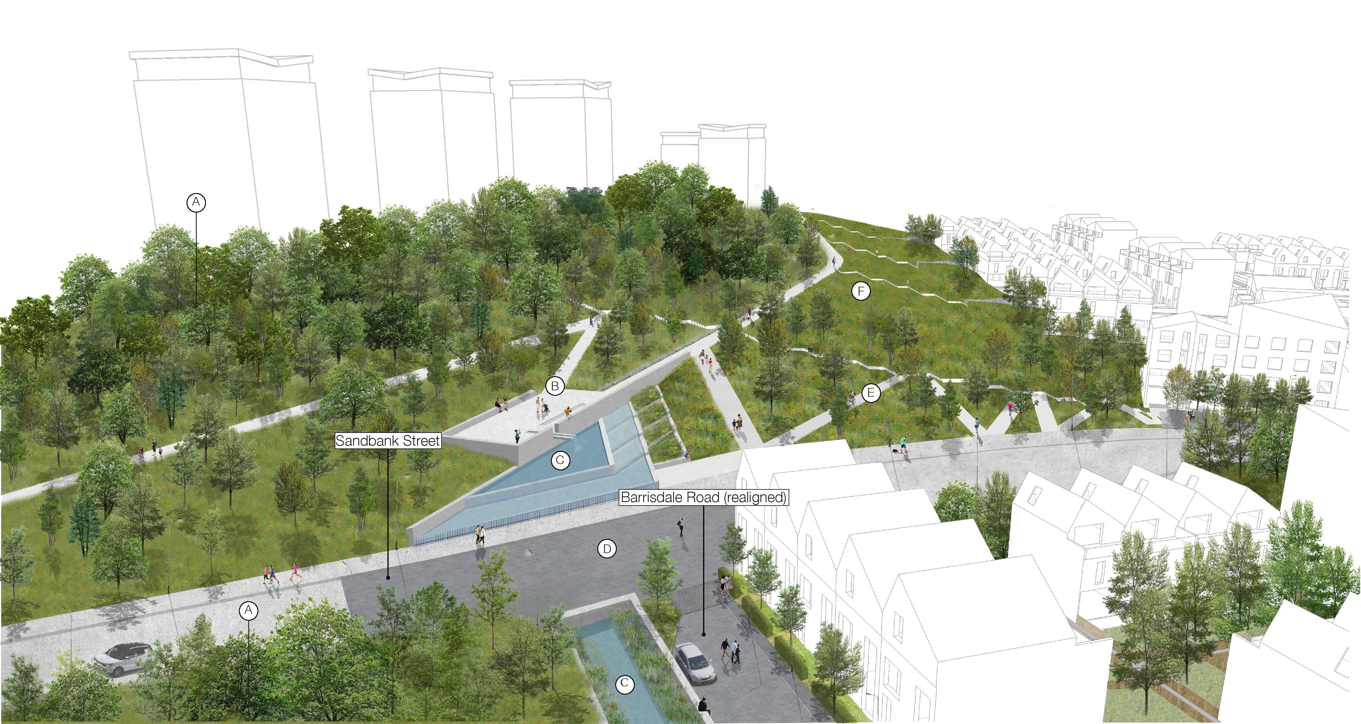
You can zoom in on the image by pinching it.
DRAG THIS AROUND OR RESIZE IT TO HELP YOU SEE
Existing woodland retained and expanded
New park
New water feature
Changes to road crossings to reduce car speeds
New paths without steps
New wildflower meadow

Barrasdale Road area
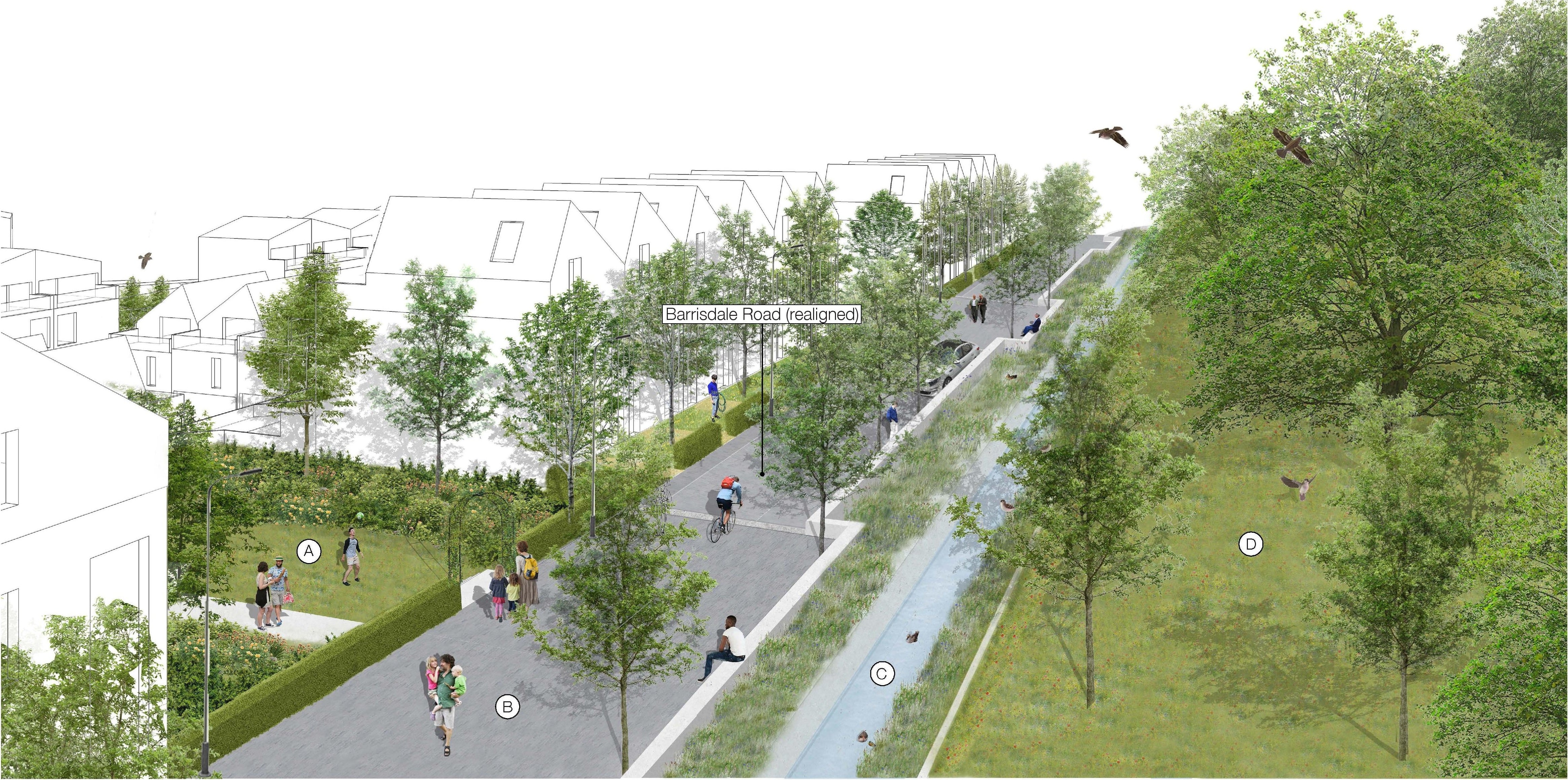
You can zoom in on the image by pinching it.
You can zoom in on the image by pinching it.
DRAG THIS AROUND OR RESIZE IT TO HELP YOU SEE
New path within new housing
New street with improved walking and cycling routes
New water feature
Existing woodland retained and expanded
